Thursday, May 9, 2013

Wandern in Germany!

Well, it's official. My son and I will be spending a week and a half in Germany later this month! We will be visiting family but also trying to squeeze in a few hikes (Wandern in German) to walk off the beer, schweineshaxe, pretzels, etc.

I am really hoping to walk around Berchtesgaden or try to get up Watzmann, Germany's second highest peak:

The Watzmann rising over Berchtesgaden
We also hope to squeeze in some time in Oberbayern, perhaps hiking to the famous Kloster Andechs for some of their famous beer.

I'll keep a log of our Wandern adventures and update the blog when I can.

Wednesday, May 8, 2013

Thoughts on the lost San Gorgonio hikers

If you haven't heard, three hikers from Oceanside were lost up on Mt. San Gorgonio from Saturday until yesterday. Hiking only in T shirts and shorts, they apparently lost the trail in the snow near the summit (at 11,500 feet the tallest in Southern California). A fourth hiker who headed back after a couple of hours of hiking got worried Saturday night when the three didn't return and so he contacted Rangers who got rescue efforts started.

Now I fully admit I'm pretty much a noob at this hiking in the mountains thing, so I tried really hard to understand their circumstances. And maybe we don't yet know the full story. But here are some of my thoughts on this situation.

First, let me say how glad I am that they were found - safe and relatively healthy. That's great news.

But honestly, who looks up at the summit, sees the snow they know they are going to have to cross, and takes off anyway, wearing only shorts? And having apparently overslept at their campgrounds, forcing a late start to the climb - still head up on a 10-12 mile (one way) hike?

I guess what got me riled up was how the media started referring to these three as "experienced hikers."

No, experienced hikers have maps or GPS. They don't get summit fever and postpone an attempt if conditions (like late starts and snow) call for it or change.

And they know enough about local conditions to dress appropriately. They might even look at overnight forecasts or forecasts based on altitude to see what they really need to take along.

So, maybe my beef is with the media. Maybe the hikers didn't label themselves as experienced.

Seeing the video, they sure looked relieved to have been rescued.

And while this was going on, another group of hikers went and got themselves lost coming down from San Jacinto's summit.

They were found after they had somehow gotten off the main trail and walked over to the Ranger Station near the tram station, where they spent the night.

So the positives from these incidents? Well, southern California has an excellent search and rescue process in place. And, sadly, they get called out too frequently.

Many of these teams are comprised of volunteers. So when you see a Ranger, or you see the SAR teams out on practice - say thanks to them. They're the first responders for us hikers and I for one and glad they are there and so good at their jobs.

Now, it's back to training for my own attempt at San Gorgonio. You can bet I won't be wearing shorts!

Monday, April 29, 2013

H2P (Humber Park to San Jacinto Peak)

Wow, hard to believe that less than a year ago I dragged my out of shape (but improving) butt up from the tram to the peak and now I get to write about a 16 mile (r/t) hike with some serious elevation gain. What a difference a year makes!

Three of us decided to take on this hike. We got to Humber Park and stepped off just before 8 AM last Saturday. The weather forecasts called for a clear day and pretty warm, with highs in Idyllwild around 70 or so.

We ran into almost no one at the beginning of the hike, and until we got to the peak trail where the hikers from the tram meet up, we really saw very few hikers. The hike up Devil's Slide was uneventful and no more snow is left on that trail.

 
Leaving Saddle Junction on a clear sunny day
The trip up from Saddle Junction was clear and sunny with excellent views down to Tahquitz and Hemet.

Does the orange fleece make me look fat?
We finally hit some patchy snow around the 9,000 foot level, where we branched off from the Pacific Crest Trail and headed out to Wellman's Divide.

Most of the snow was patchy and pretty easy to get around. But even when we had to go up and over, we never really dug down in (post holing in hiking terms).

The trip over to Wellman's Divide was another beautiful section for weather. The snow was gone and had beaten down the shoulder high brush that we encountered last September. At the Wellman's Cienega run off, water was flowing freely and we encountered three mule deer drinking from the stream off the trail.

Our next break stop was Wellman's Divide at 9,700 feet. We had hiked over 4 miles and gained about 3,000 feet of altitude so we were ready for the stop.

Best trail mix in the world, at least at 9,700 feet!
From Wellman's we had just under 2.5 miles to go to get the the summit at 10,850 feet. After a much shorter break than I expected we were off. One of our group was really feeling the altitude by now, even though he had powered up Mt. Baldy last fall and is in great shape. The going was slow with many short breaks for him to catch his breath and let his heart rate fall. We kept close watch and he never had any severe symptoms, so on we pressed.

After those two long (and I do mean long) switchbacks, we finally saw the last trail sign before the summit.

Yes, we had already climbed 7.3 miles!
Yes, the sign was in the snow and we hit a few patches of it, but it was all very manageable. The dry winter up there doesn't bode well for our water levels this summer. Be prepared to stop washing your cars soon.

I have to say that compared to last year, I was doing pretty well with the altitude. The walk up to the rescue hut seemed to go pretty well this year. Last year I was using the technique of counting steps and picking out trees and other landmarks and telling myself, I can make it another 10 steps, or I can make it to that tree. I Guess I am in better shape this year. That feels pretty good.

Finally the rescue hut appeared. Built in 1936 (I think) by the CCA to provide storm shelter, it is the last landmark before the scramble up to the summit.

A quick break to load my hiking poles (not easy to scramble up boulders with them), and we were ready for the scramble. Two volunteer rangers coming down remarked on how they liked my bright orange fleece. So far, every ranger I've encountered while wearing it has said the same thing. If I need rescue I want to be seen! Which always amazes me when REI and others only sell light green, grey, and khaki colored clothing - but that's a topic for another post.

The final scramble really isn't rock climbing and if you pick the right spots, you don't even have to "scramble" in the real sense of the word. The route I picked was a combination, especially since my knees don't bend like they used to.

Seeing the summit sign so close is a great motivator!

Once at the top, the weather was great, the wind was calm and the views were fantastic!

10,850 feet! And still able to stand and breathe.
Of course, some hipsters and tourists had decided to camp out at the summit sign and geo plaque, so we couldn't get our obligatory tourist pictures, but of course, I took my obligatory selfie:

 
Rocking the edelweiss buff!
The trip down was pretty quick and uneventful. I stripped off the fleece at the rescue hut since it was only going to get warmer as we descended. Once we did turn southward again, we could see a rescue helicopter circling Tahquitz Rock (also know as Lily Rock). It turns out a rock climber had fallen and required a full rescue response.

I have to tell you that Devil's Slide going down seems absolutely endless. That final 2.5 miles is all downhill, but just seems to keep on going. Seeing the parking lot was a final happy moment!

Tired but happy!
So, 16 miles of hiking, 4400 feet of elevation gain - was it worth it? Absolutely! it was a great start to the season, and this year I am determined to captured all three saints before the snows blow in again. We might also do this trip again, or go up Deer Springs to the summit.

Two of the three hikers are planning on a cactus to cloud trip in the fall. Nope, I'm not one of them. See you on the trails!

Monday, April 22, 2013

Getting ready for San Jacinto means walking, lots of walking

So this coming Saturday, weather permitting, we'll do the Humber Park route up to Mt San Jacinto's summit. To help prepare, I thought we should get some mileage in last weekend. My first thought was the Big Laguna trail up near Julian which is a 10.25 mile loop and includes some PCT.

But since our San Jacinto attempt is around 16 miles, we thought we could add some distance by heading up to Garnet Peak before hitting the PCT. That would stretch us out to about 14 or so miles.

Not a bad Saturday outing. And, being this close to Julian meant we could indulge in some apple pie at the end.

What I forgot about in the midst of my fantasies about Julian apple pie was that hiking with a former Marine officer meant hiking fast. And since my nickname is "Old and Slow" this was going to be interesting.

It was a beautiful Saturday morning when we arrived at the Penny Pines parking area, and by the dearth of parking spots, we weren't going to be the only people enjoying the trails.

But for the 2.5 miles up to Garnet, we were indeed pretty much alone. The peak is a short scramble after some pretty moderate elevation gain and a winding, well maintained section of the PCT. Great views from the granite boulders, and the wind was very light. It was already warm enough for me to get down to just a hiking shirt and pack away the undershirt. After a quick rest and signing of the peak register, we were off.


We had already decided to do this route clockwise, which meant going against traffic on the PCT and as soon as we were past the scramble, we started meeting through hikers for this season's PCT attempt. Starting this early, they must be pretty confident that the Sierras will be clear when they get to them in a month or so - a sign of our very dry winter months. Good for early hiking, not good for Southern California's water resources.

Once we got around the bend we had a clear view of our path ahead, looking over to Foster's Peak, Mt. Laguna, and the desert below.

Yes, it looks like a long way away, and it was! The walk was great, the PCT was not overly crowded and we had enough shady spots to cool off. I took the lead for much of this leg, and surprised myself at the pace we were all keeping. This was our "uphill leg" and so maintaining a 3 mph pace was really good for me.

Once we got over to Foster's Peak, we had a glorious view back at Garnet.

The rest of the hike (about 9 miles) was the usual Big Laguna trail - warm, dusty, mountain bikes, and other hikers. The lake was fuller than I expected but otherwise we just powered through that section.

All told, about 14.5 miles, around a 3 mph average speed, and a couple of sore legs. I think we're ready!

Wednesday, April 3, 2013

Return to San J

Well, if the weather holds and the trails clear a bit, it looks like we're going to try to summit San J at the end of this month. Rather than using the Tram like we did last year, we'll be starting at Humber Park for a 16 mile round trip trek. Let the training begin!

Monday, April 1, 2013

Check your gear!

OK, so I jinxed myself apparently when I wrote about my ritual of getting ready before hikes. As I mentioned in my last trail report, my not securing a lanyard to my GPS case meant that my GPS is now up on the side of Tahquitz Peak, or in someone else's pocket (enjoy it if you have it). The legend of Tahquitz's curse of that mountain lives on.

I almost always forget something. Usually it is my Adventure Pass for parking or something else pretty insignificant, but sometimes even the small stuff can take on new significance at 8000 feet and above. And I haven't even started backpacking or overnight trips. Woe to me if I forgot my Via packets on a trip like that.

I've also learned to check gear pretty soon after a hike or outing. Nothing like a moldy water reservoir to get that point across!

I guess I need to get into checklists.

How do you prepare? Let me know in the comments.

Tahquitz Valley via Devil's Slide

It was a beautiful day last Saturday, and my hiking partner and I decided to try a loop from Devil's Slide over to Tahquitz Peak and then down the South Ridge trail into Idyllwild. We also considered Devil's Slide over to Wellman's/Strawberry Junction (up to about 9000 feet).

My hiking partner is recovering from a broken leg, pretty much the same injury we saw during March madness the other night, and we've been hiking together as he gains his strength. He's usually pretty hard core, so this is a rare chance for me to be able to keep up with him.

The rangers and volunteers we met at the Ranger Station and on the Devil's Slide trail warned us of the snow we'd encounter on both routes, so we headed off to Tahquitz, via the PCT and decided we'd take conditions as we found them and return if it got too hairy.

It got too hairy!

But I get ahead of myself.

The walk up the Slide was a quick one. Just over an hour to get up 2.5 miles. Once at Saddle Junction and having encountered minimal snow, we headed out on the PCT towards Tahquitz. It was already a warm, cloudless day and we were really enjoying the scenery.

We finally hit snow around 8300 feet, but it was pretty spotty and we still didn't need our Micro Spikes.

At the Tahquitz junction we could see tracks heading out on the usual trail as well as some that look like they went straight up into the snow. We also ran into a lone hiker who asked to tag along. So off we went, inching our way along the side of Tahquitz. About a tenth of a mile in, we hit a shady spot and ice, so we decided it was time for the spikes. After another tenth of a mile and lots of postholing, we decided that was enough.

Lunch break.

The shot above are our tracks, which we followed back to the junction, as seen below.


Things were pretty routine from there until I discovered my GPS was missing. Damn if I had neglected to string up a safety lanyard to it before setting off. So I hiked back up to the junction (I guess I needed the extra mileage) to see if I left it out during our break there.

No luck and there was no way I was heading back out into the snow by myself, so I chalked it up to Tahquitz curse.

On the way back I was rewarded with a beautiful run off/melt water waterfall we had missed on our way up. It was beautiful and calming and reminded my why I hike. I also remembered my GPS was a used basic model from Craig's List, so the rest of the way down was calm and uneventful.

I did stop by the ranger station to file a lost gear report. We'll see if someone finds it out there when the snow really melts away.

It was a beautiful walk on a warm, sunny day. And time in the mountains of southern California is never wasted!

Saturday, March 30, 2013

Getting ready to hike

Does anyone else turn preparing for a hike into a small ritual? Maybe it is my ADHD (I'm not just jumping on a bandwagon here, I've had it since childhood - a LONG time ago), which means I inevitably end up forgetting something. Maybe it is timed to psych myself up for the hike ahead.

I don't know exactly.

But it has become a comfortable night before and morning of ritual. Preparing and cleaning gear. Planning out evening and morning meals for maximum nutrition. Checking maps, weather reports and trail reports for the proposed route. Laying out the clothes for the hike and then piling it all into the car.

Of course it drives my dog crazy. He thinks this all involves himself or that he is about to go on a grand adventure.

So, do you have a pre-hike/bike/workout routine? How did it come about? How does it work for you?

Let me know.


Tuesday, March 26, 2013

Catching Up

Yes, I know. It's been a while. An eternity really in "blog time." And most of you have probably abandoned my pithy little blog for greener (or at least more active) pastures.

I understand.

But I haven't been idle and the old man has continued hiking as well as adding in bicycling as well.

So, a quick synopsis. Since my last post, I've hiked Sitton Peak in Orange County, CA, the Cedar Springs trail and PCT to Pyramid Peak south of Idyllwild, the Deer Springs Trail north of Idyllwild, and Devil's Slide on my birthday which turned into a snowy mush towards Tahquitz Peak.

So I haven't yet slunk back into my old slothful ways. I just got lazy and stopped blogging about it. My knee did start giving me fits when I added jogging to my daily walking route, but a cortisone shot seems to have helped. And my doctor still thinks I need to lose a bit more weight. I'm now down about 40 pounds from when I started hiking in 2011.

Oh, and the bike.

My son surprised me on Christmas morning that he wanted to get me a bike for Christmas. And after careful consideration of his financial situation, as well as ours - we compromised. My wife paid for the bike and my son paid for some accessories.

So I now have a Scott Sportster 55 hybrid bike in the garage. Basically a hard tail mountain bike frame with 700c wheels and tires. I didn't think I was ready for a 29er and I knew I wasn't ready for an Italian road bike. Plus, this was on clearance at REI. All the better.

The Sportster and I make regular use of the San Luis Rey mixed use trail near our house. 18 miles out to the Oceanside Harbor and back, often times out in some wicked headwinds coming down through that valley.

So, I'm back. I'll keep this updated, I promise. This year plans on being an exciting one with Mt. San Gorgonio in my sights as well as longer treks overall. I'll keep you all posted.

Saturday, December 1, 2012

A quick Saturday hike

After the rains from the last couple of days, we didn't know if we'd pull off a hike today or not. But man, did I need one. It has been a long week of mainly being tied down to a chair and I was feeling sluggish by Friday.

Even last night, we weren't sure what conditions would be like when we all awoke.

Truth be told, I fully expected to head out on my own this morning.

As it turned out, I joined companions Bill and Linda in San Diego's east county, just east of Poway, for a rugged little hike near Iron Mountain known as the Ellie Lane Loop. The trail head is about a mile north of the main (and crowded) Iron Mountain trail head.

The loop consists of some big ascents (for urban hiking) up to two different saddles, then a descent over to Iron Mountain. An optional loop can take you up to the top of IM, and then you can return back the same way or loop back out to the parking lot and starting point.

Our first ascent confirmed that I can never take a week off from walking again. It's steep. And we started in the fog.


The storm front is moving away so we had clearing skies and decent trail conditions. In fact, below is probably the worst puddle we ran into.

So much for those horrible conditions!

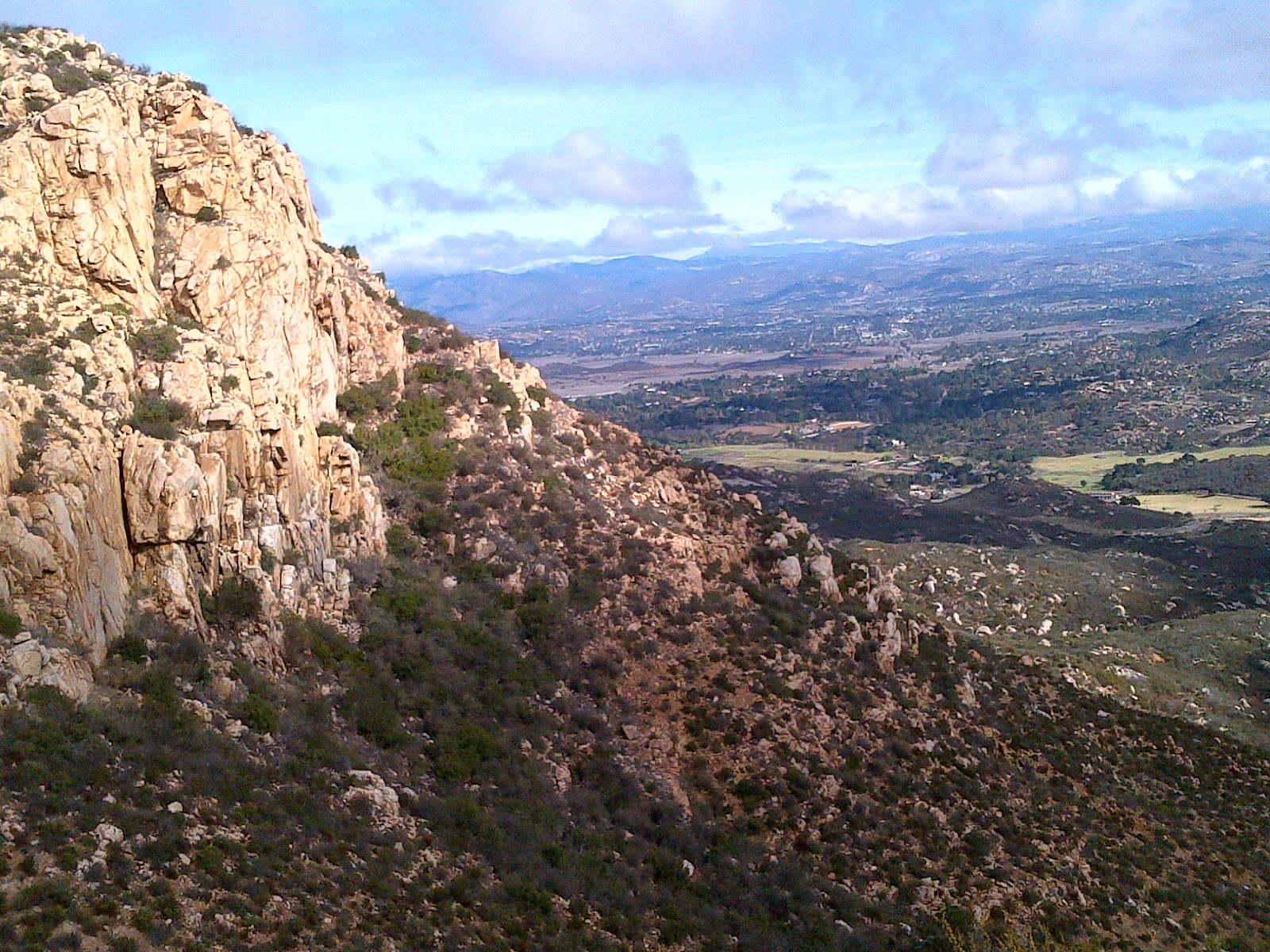
Once up to the final saddle, we had a wonderful view to the valleys east of us and down into the village of Ramona.

I'm still not sure why these granite slopes aren't more frequented by rock climbers. If you look hard enough you can almost see the pie shops in Julian - far off in the distance. But I digress.

From this final saddle, we had a pretty steep descent in order to drop and loop over to the Iron Mountain trail.

So, by this point we had come 3.3 miles, plus a bit to get to the top of the Ramona Outlook. Today, we decided to skip the peak of IM, mainly because of the crowds already on the main trail. And hamburgers. We had planned on hitting the Hamburger Factory in Poway for our after hike meal and the place was calling us.

We hiked on towards the main trail head, knowing it would be another mile and a half past that to our cars. It was on this leg that we ran across Mr. Rattler, angrily letting us know we had disturbed his nap as he slid off into the bushes. See my earlier post about that encounter.

It was a great walk, nice weather, and really - pretty good trail conditions. If you are out this way, give the Ellie Lane trail a try and miss the usual Iron Mountain crowds.

Oh, and I'm getting the hang of my GPS, so here's a quick glance at our walk.


And the Hamburger Factory? Highly recommended!

http://www.hamburgerfactory.signonsandiego.com/


First Rattler Encounter

OK, that headline may not sound like much. After all, I live in Southern California and rattlers are everywhere and anywhere trails seem to be.

So running into one on the side of the trail isn't a big deal, right? Well, probably not until you realize that besides being old, I also have a real (I mean REAL) phobia of snakes.

So, seeing one is a big deal for me. And the good news is I didn't freak out today.

Some day I'll write down what I've discovered about phobias and dealing with them. But suffice it to say, not freaking out today was a milestone for this old hiker.

Thursday, November 29, 2012

Baby, it's cold outside...

That old song resurfaces every holiday season, just like eggnog. So my thoughts turn to hiking when it is cold outside, even if it is only Southern California cold.

It was pretty cold going up to the summit of Baldy in October, in the 40's for much of the morning. And it is bound to get colder at the higher altitudes.

Admittedly, down here closer to sea level, we'll deal with much milder temps.

Still, the answer to both situations, for me at least, is layers. Rocket science, right?

But ask a few of my hiking companions and you'd think we were going to tackle Everest in down suits. Hourly charts are consulted, wind chill levels determined, and forecasts that include comfort are studied.

Last winter, I hiked alone to our local peak, Iron Mountain (yes, THAT Iron Mountain) in the rain and cold. Alone, because no one else wanted to head out in the fog and drizzle. I wore about four layers that day and had a blast. The summit (can you call the top of a hill a summit? Yes you can, it is my blog after all.) was was cold, foggy, and deserted. Perfect for that day.

Alone at the top of Iron Mountain in the fog and drizzle


Later in the spring we hit Mt. Laguna, outside of Julian, a couple of days after a late season storm dropped about four inches of snow on the area. We had a blast! Again, layers and gaiters made it all the more comfortable.

Big Laguna Lake along Big Laguna Trail, San Diego County

You don't often get to hike in scenery like this in San Diego.

So, where was I? Oh yeah...the cold. Layers are the answer and something else. I learned this from a great kayaking instructor. "Cotton kills." It gets wet, stays wet, gets heavy and cools you down faster than just about anything. Get modern "tech" fabrics, you'll appreciate the difference.

So, if an old man like me, spoiled by years in the southern California sun, can get out into the cold, so can you. Let me know how you like it.

Saturday, November 24, 2012

Cross training

Today was a cross training day. For me that usually means getting out in a kayak.

I started kayaking a few years ago with my son when we took a tour of Big Bear Lake and its many nooks and crannies. We've been hooked ever since.

Today was a windy day out on Mission Bay in San Diego, with my grandson along as well as some friends fairly new to the sport.

The legs appreciated the break after three different walks yesterday, and the core and arms wondered what was happening!

Cross training is always mentioned as an important aspect for any sport. It prevents burn out and widens your own perspective. For me, the water will always be a place to relax, get some exercise, and burn off the stress. Yes, hiking does the same, but differently.

Our shop of choice (full disclosure, my son has worked there for the past four summers) is Aqua Adventures on Mission Bay. They have a great selection of boats - sit on tops and sit ins, as well as stand up paddleboards. And it is a great location for launching and getting out onto the water.

http://www.aqua-adventures.com

Hike Local

Today was Small Business Saturday, an attempt by a large multinational corporation to get more money into their coffers by promoting small local businesses. But I digress.

Have you tried walking or hiking locally? Even in your own neighborhood? Not every hike need involve topo maps, planning, and driving several hours to the trail head.

A 4 or 5 mile walk around your town or neighborhood can be good exercise and an eye opening experience. Sure, you'll learn how bad drivers really are, but you'll also hear and see things that you may usually miss when you drive by.

For an old man like me, a neighborhood walk is a nice alternative to the treadmill.

Try it.

Wednesday, November 21, 2012

“Life is a journey, not a destination.” 

 Ralph was right everyone. (Ralph Waldo Emerson that is, not sure about Ralph Kramden!) Have a great Thanksgiving holiday. Stay safe and get some miles in.

Tuesday, November 20, 2012

Solo Hike, Tahquitz Mountain, Idyllwild California

One of the joys of hiking is the solitude it can bring. People who know me, know I'm not the most outgoing person in the world. If you are familiar with Gallup's Strength Finder book and program, I don't have a lot of what they call WOO (winning others over). So solo hikes can really be a chance to get in touch with everything around us.

Tahquitz is a soaring granite peak jutting up out of the San Jacinto wilderness over the mountain village of Idyllwild. It is named after a Native American tribal chief who cursed the area in old "urban legend."

That curse struck twice this year. The first time we tried to get up Tahquitz, snow and ice on the slope made us decide to stop about a half mile short of the 8850 foot summit. Then my son and I decided to try it with a co worker and his wife. My son had back spasms on that trip and couldn't make it up, so strike two.

For my third attempt, I decided to try it solo. At least that way I could deny even attempting the hike if I failed a third time.

My wife decided to come along, drop me off, and go enjoy morning coffee. The drop off was in Humber Park, base of the famous Devil's Slide trail. This trail heads up what used to be a near vertical path that was used by cattlemen to get their herds up to the meadows. Now it is often referred to as Angel's Shuffle due to its switchbacks and easier going. It leads to a junction where several trails then branch off.

At the start of the hike I stepped off with a man who was training for a Rim To Rim hike in the Grand Canyon. He wanted to do that hike in 10 hours. Needless to say in about 50 yards, he was gone, leaving the trail to me.

Now, I should tell you that my hiking style, especially at altitude, is to take little breaks to catch my breath, but not long enough to let muscles tighten up. So please don't expect a trail running report from this old hiker!

This trail also features a section of the Pacific Crest Trail, the famous PCT - a 2600 mile trail from the Mexican border to the Canadian border. I figure at this rate, I'll complete the PCT in about 1000 years!

The trail remained clear and open and I soon came up on the spot where snow and ice had blocked us in May.
The shot above doesn't really give the true perspective of the drop off and angle of the slope.
Many hikers get "summit fever" and decide to bag a summit, no matter what. But this kind of trail, covered in packed snow and ice would be no fun unless you had micro spikes or crampons. I was glad we stopped.

At the top, there is a fire lookout tower
A quick scramble up and then...success! The tower is staffed only during the fire season, and the weekend crew hadn't yet arrived the morning I was there.

I reversed my route and headed down after a quick break. Once off the mountain trail, I ran into way more people. Devil's Slide is a permit only trail and they regulate the number of weekend permits, so I had started early. You'll notice that hikers are a very friendly group. Almost all of us pause just long enough to offer a greeting.

So, an 8 mile hike with about 2500 feet of elevation gain. It took me just over 4 hours. But remember, I'm an old hiker who takes a lot of short breaks. It can easily be done more quickly, but not by me!

The peak is a great walk, as is Devil's Slide. I highly recommend this trail for just about any skill level. Heck, I made it!


Welcome to the Old Man Hiking blog

Pick up any outdoor or backpacking magazine and you've seen them. Thighs like old growth tree trunks, sculpted calves, and only the best gear.

That's not me.

Last year at about this time, I was fat, had uncontrolled blood pressure, and my big sport was weekly bowling in a local beer league. Not exactly hiking material.

But a couple of the bowlers I knew hiked occasionally and had completed the Mt San Jacinto hike earlier that year. They - somewhat cautiously - agreed to let me tag along on a local hike.

That hike was Iron Mountain, here in San Diego's east county. That morning the wife of one of the hikers was going to come along, to keep me company when I stopped. Yes, I was in such bad shape, no one thought I could make it up a 2.5 mile ascent to a "summit" well under 3,000 feet high.

I made it up Iron Mountain that day and was hooked.

Now, a year later, I've lost 30 pounds, my blood pressure is fine, and I've bagged two of the highest peaks in Southern California.

This is me on the infamous Devil's Backbone in October. I still have a long way to go, but I decided to start this blog for everyone who thinks they can't do it and to highlight some of the amazing trails and back country spaces right here in Southern California.

I hope you enjoy!